


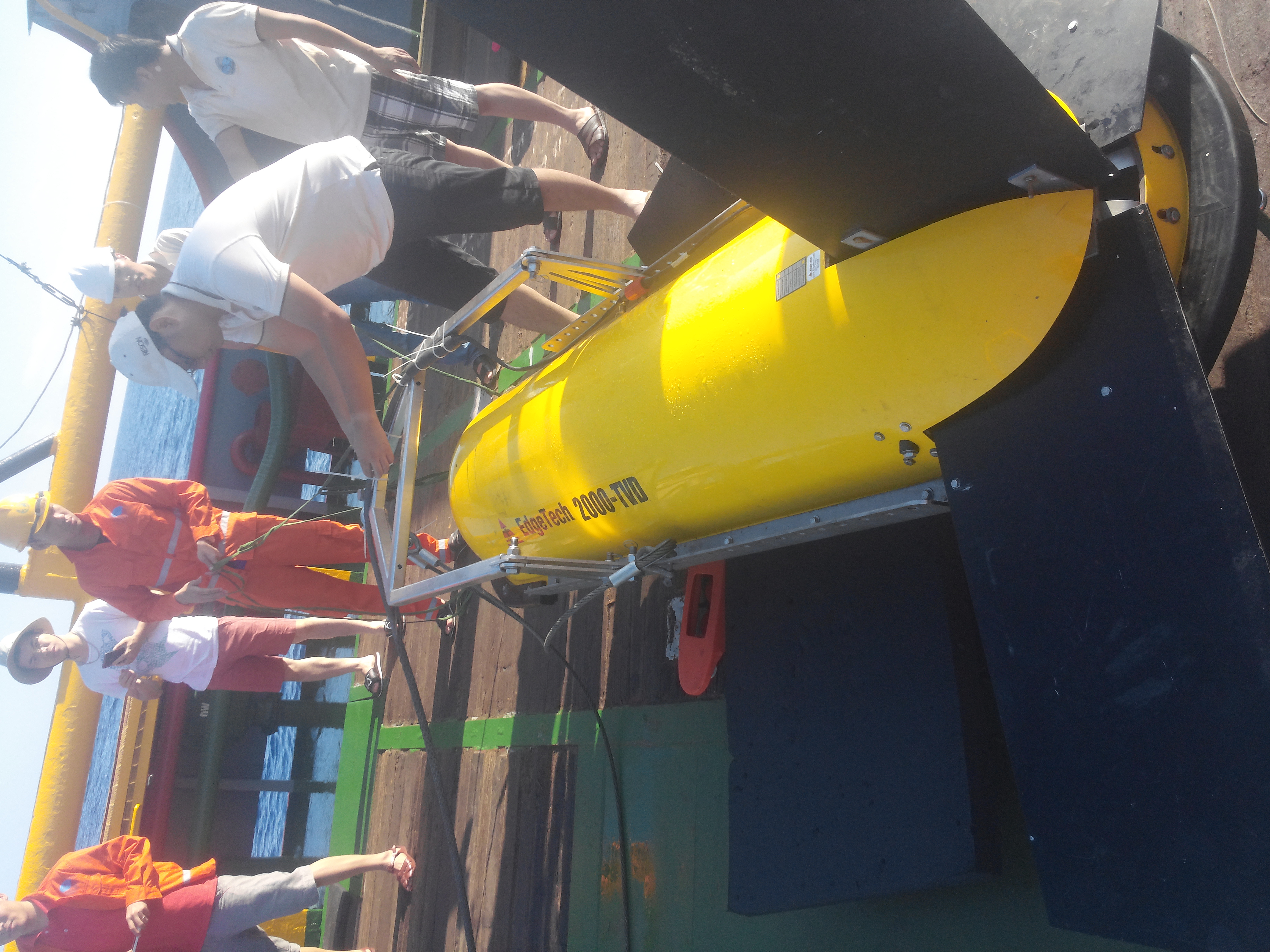
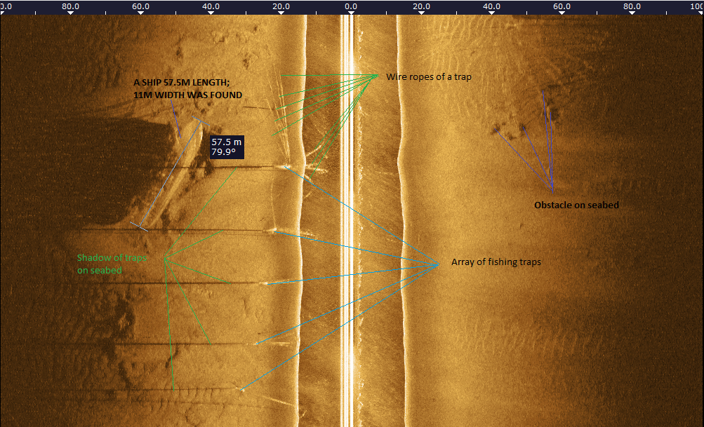
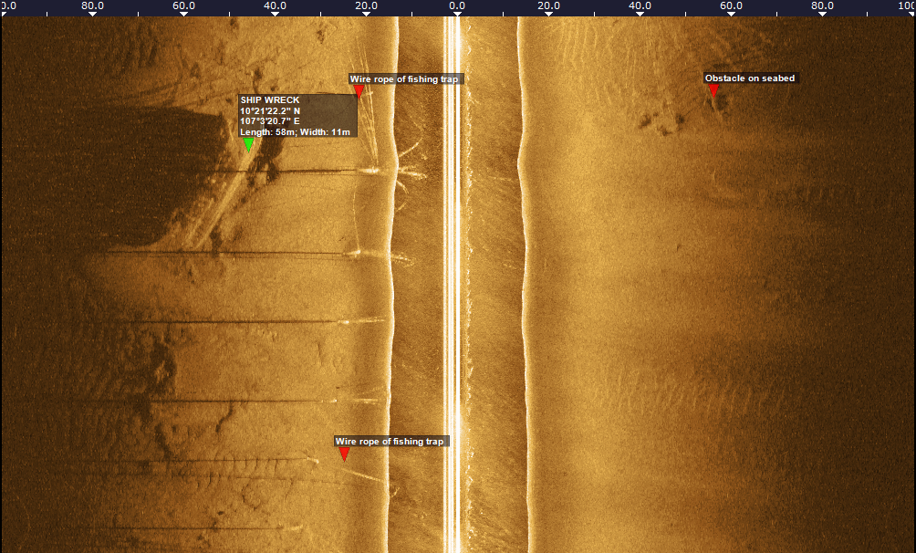
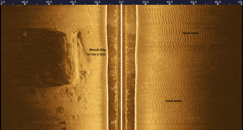
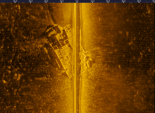
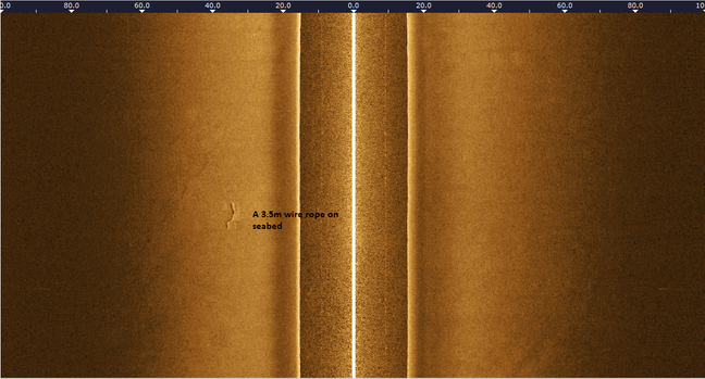
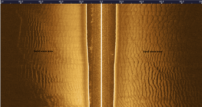
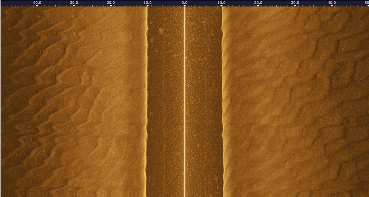
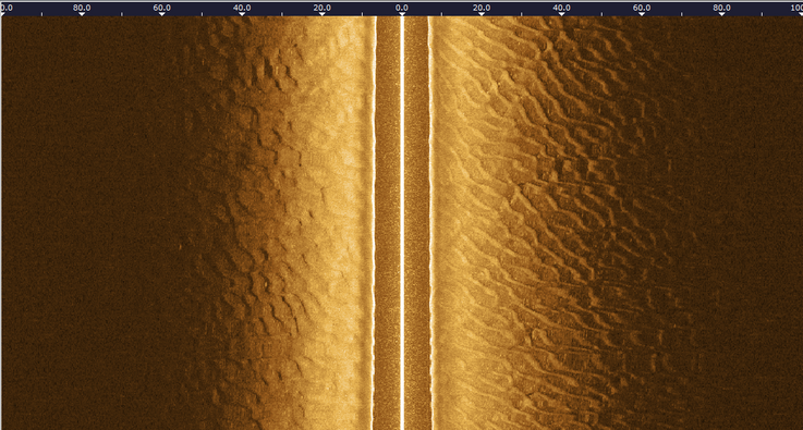
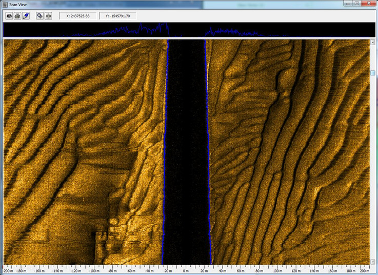
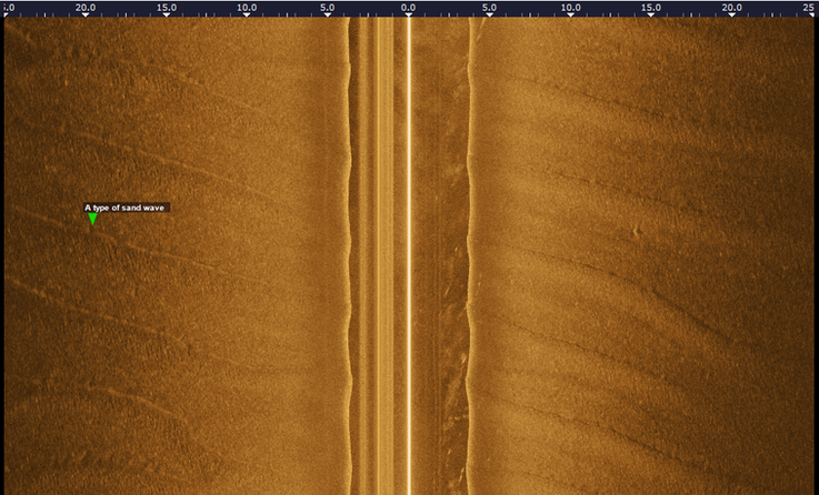
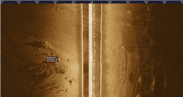
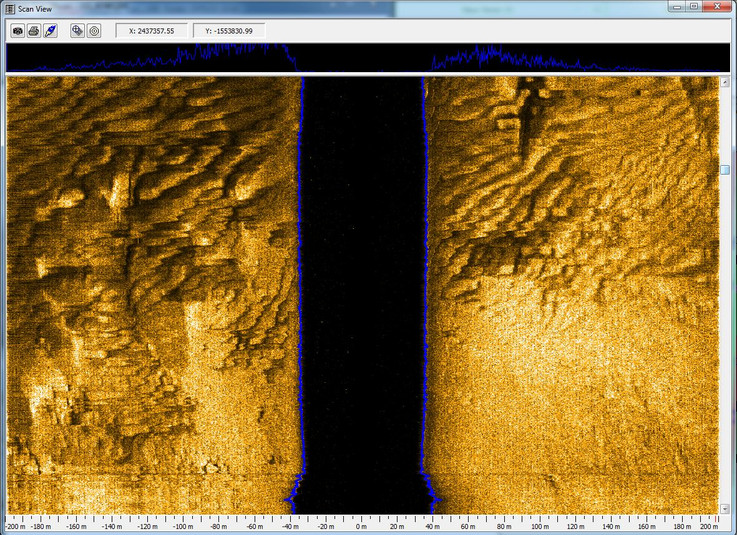
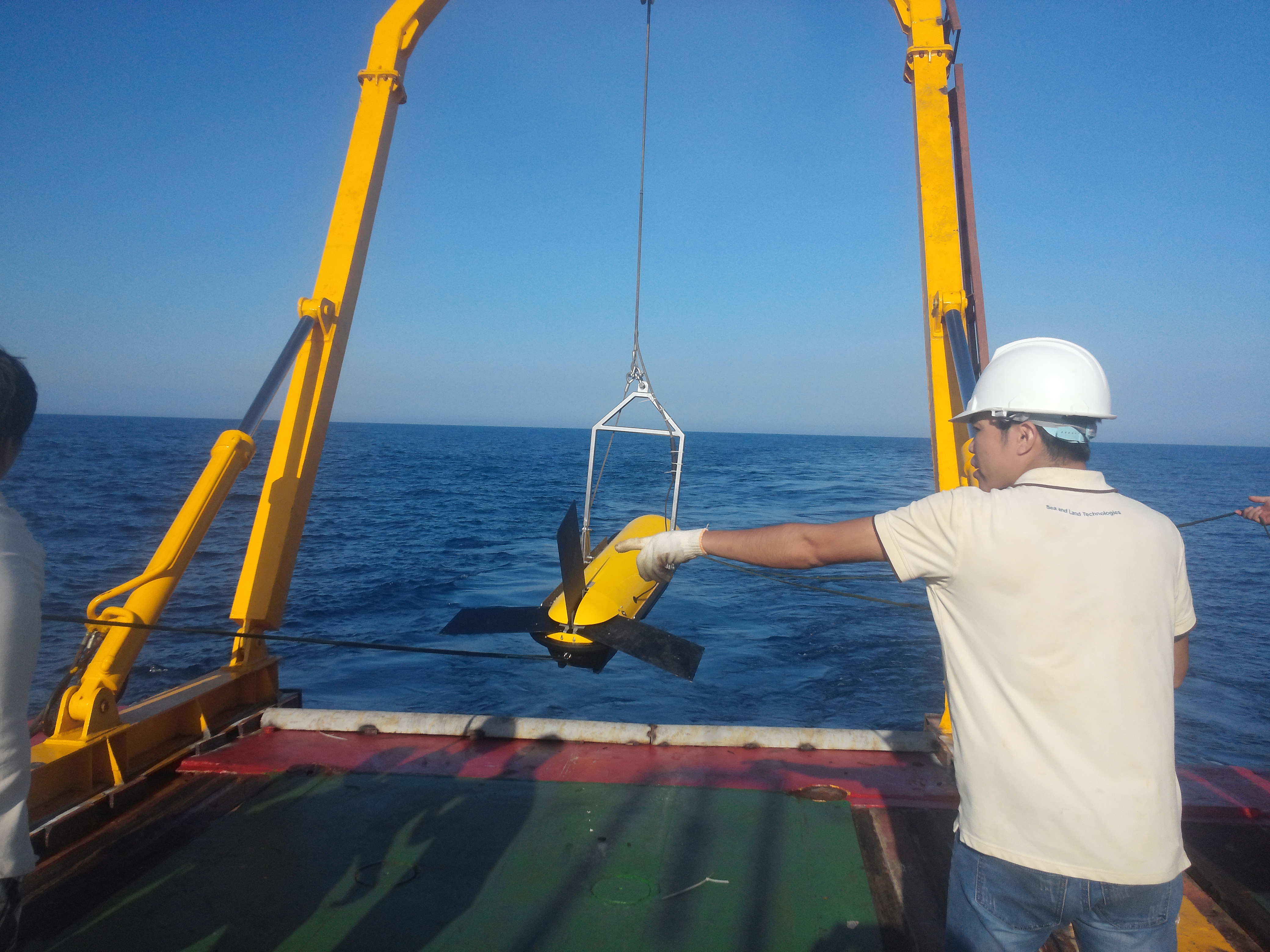
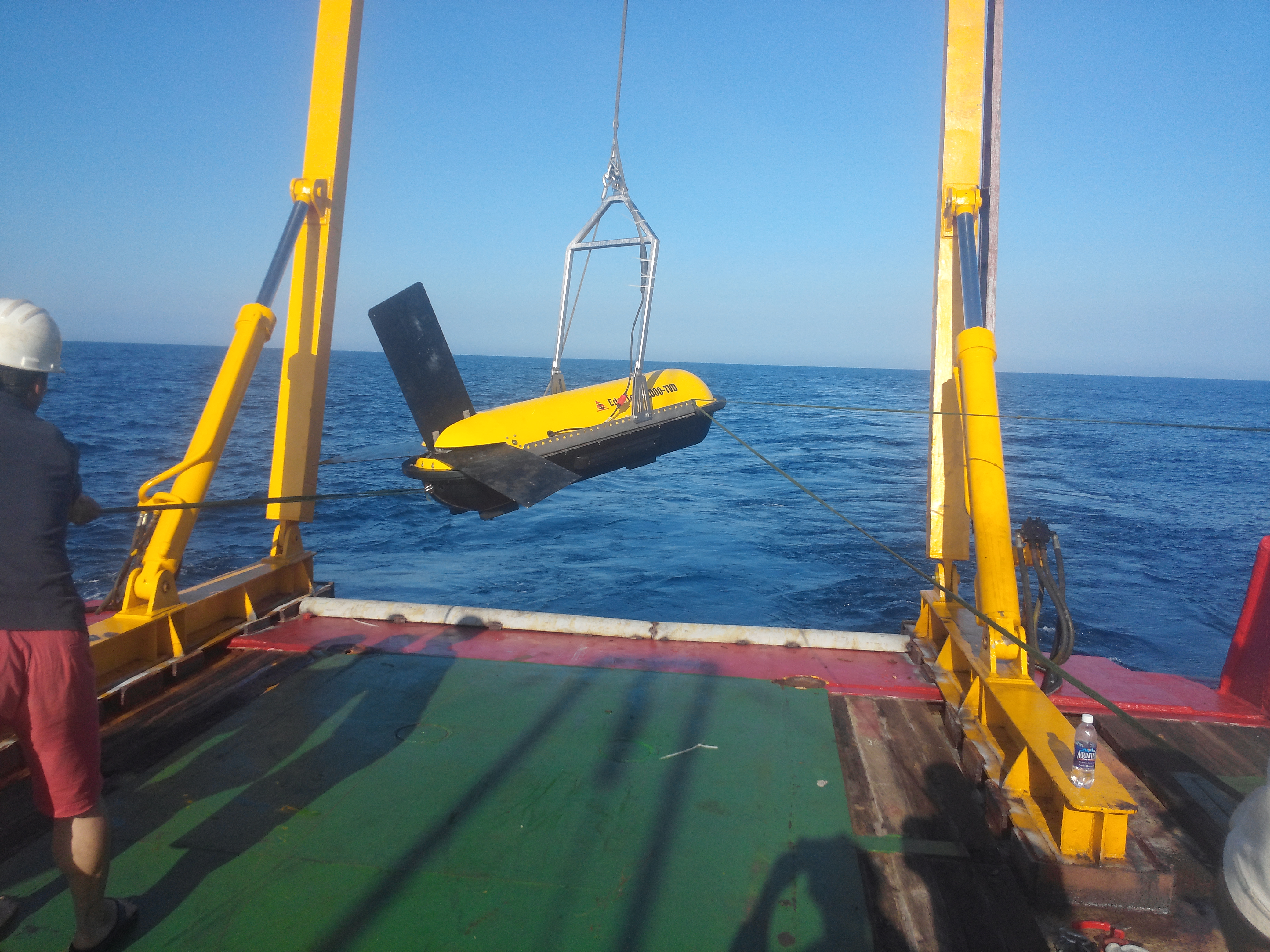
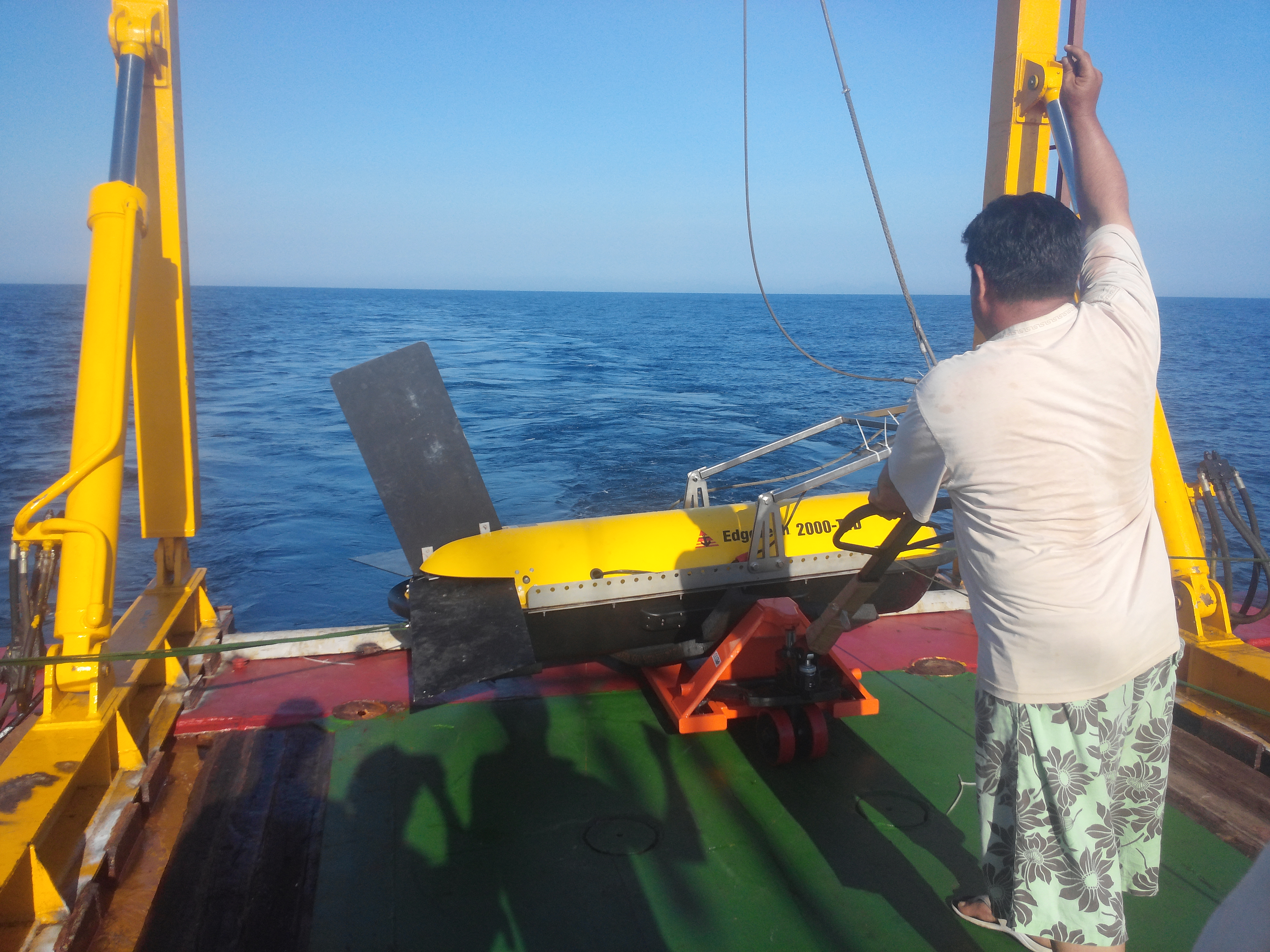
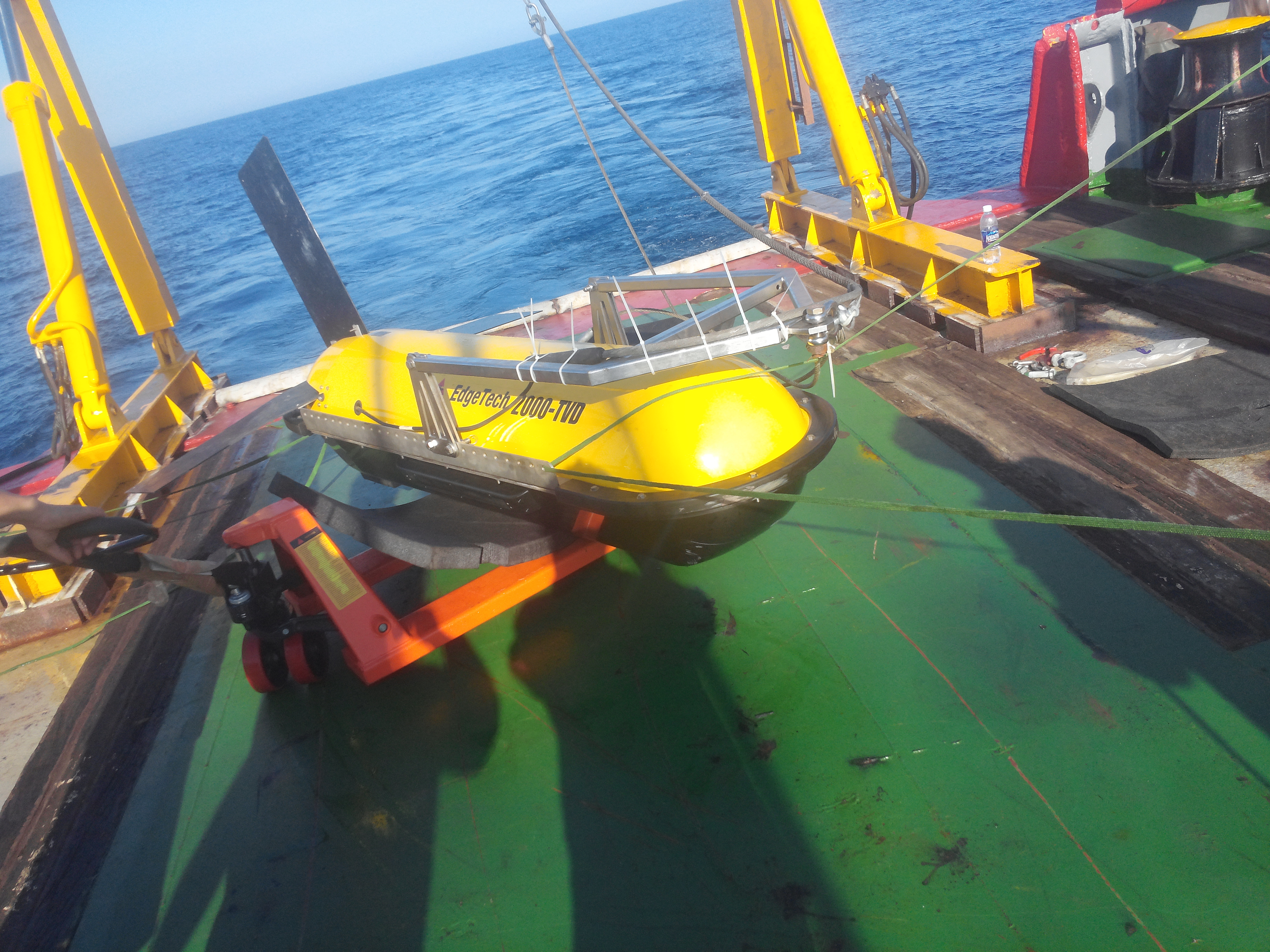
Side-scan sonar is a category of sonar system that is used to efficiently create an image of large areas of the seafloor. This tool is used for mapping the seabed for a wide variety of purposes, including creation of nautical charts and detection and identification of underwater objects and bathymetric features. Side-scan sonar imagery is also a commonly used tool to detect debris and other obstructions on the seafloor that may be hazardous to shipping or to seafloor installations for subsea field development. In addition, the status of pipelines and cables on the seafloor can be investigated using side-scan sonar.
APPLICATIONS:
- Cable & pipeline surveys
- Geohazard Surveys
- Geological/geophysical surveys
- Mine countermeasures (MCM)
- Channel clearance
- Search and recovery
- Archaeological surveys